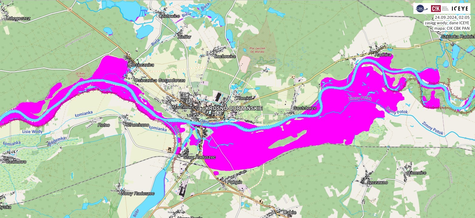
In reponse to the flood crisis in South-Western Poland, the Crisis Information Centre of the Space Research Centre of PAS launched a dedicated satellite monitoring system on 13th September. The system detects areas where water has overflowed from the riverbeds. The operation is conducted in collaboration with the Polish-Finnish company ICEYE, which owns the largest civilian radar satellite constellation observing the Earth. ICEYE delivers data and reports every few hours and CBK PAN distributes them together with a quick-view maps to the State Fire Service, crisis management centers, the Institute of Meteorology and Water Management and water authorities. CBK PAN has also coordinated collection of detailed optical satellite images and prepared a number of maps and analyses based on them.
During rescue and recovery operations, swift access to information helps recuers and decision-makers to better understand the evolving situation on the ground, assess the demage and direct resources where they are needed most.
More information: https://informacjakryzysowa.pl/en/aktualnosci/cik-kontynuuje-dzialania-wspierajace-sluzby-w-walce-z-powodzia
